

.jpg")
River Bank Work at Floodplain Forest Nature Reserve

If you’ve recently visited Floodplain Forest Nature Reserve in the Ouse Valley, then you may have spotted our team carrying out some important work on the river bank near the Iron Trunk Aqueduct.
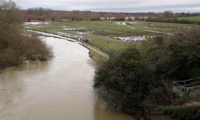
During Christmas 2020, there was heavy flooding in Ouse Valley Park and the surrounding areas which caused a river bank to collapse (pictured below). This resulted in the loss of a footpath, so our team had to quickly put a diversion in place for visitors enjoying their Boxing Day walks. This summer, our team created a new pathway to improve access for visitors, using recycled materials where possible from the old pathway.
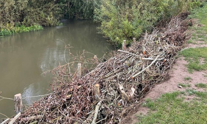
Due to the close proximity of the canal aqueduct and footpath, our operations team have also been working hard to help protect the river bank from significant erosion in future periods of high flood. To do this they have been pollarding nearby Willow trees which in turn has opened up views across the Floodplain Forest. The pollarded tree branches have been used to create approximately 90 bundles which are roughly 2 to 3 metres long and 1 metre in width.
Over 70 metres of stakes and willow bundles were then placed along the river where they will start growing and laying in roots to help protect the bank edge. Some of the willow bundles made will also be used to help protect the river banks in Ouzel Valley Park.
The river bank will now be graded and reseeded and the area will continue to be maintained by our operations team. Find out visitor information for Floodplain Forest Nature Reserve here.


